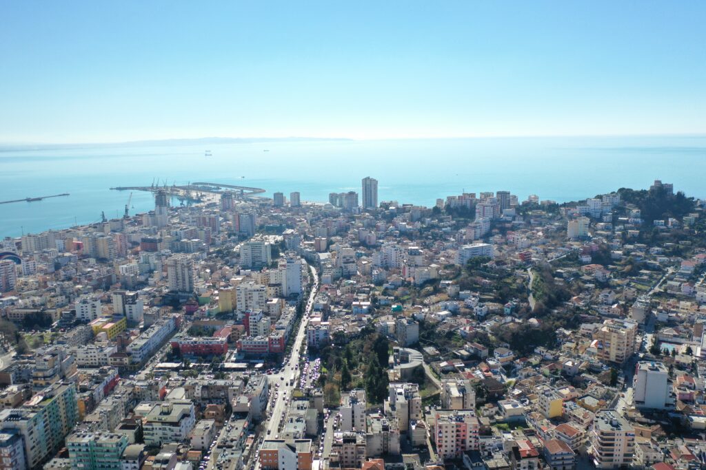
The history and map of pre-Roman and Roman Durrës were recently enriched with the monuments that came to light during the excavations at the Eftali Koçi School after its demolition due to damage sustained from the earthquake of 2019.
The school was scheduled to be rebuilt with the support of UNDP (EU4Schools), and archaeological excavations were necessary to identify, document, and evaluate cultural heritage remains that could be affected from the construction activity.
The area in question is located northwest of the modern port of Durrës, on the lower part of the eastern slopes of the Dautaj hills, near the locations mentioned above. The necropolis in the Dautaj hills is not far from the school territory, and the votive deposits of the Artemision is about 480m away.
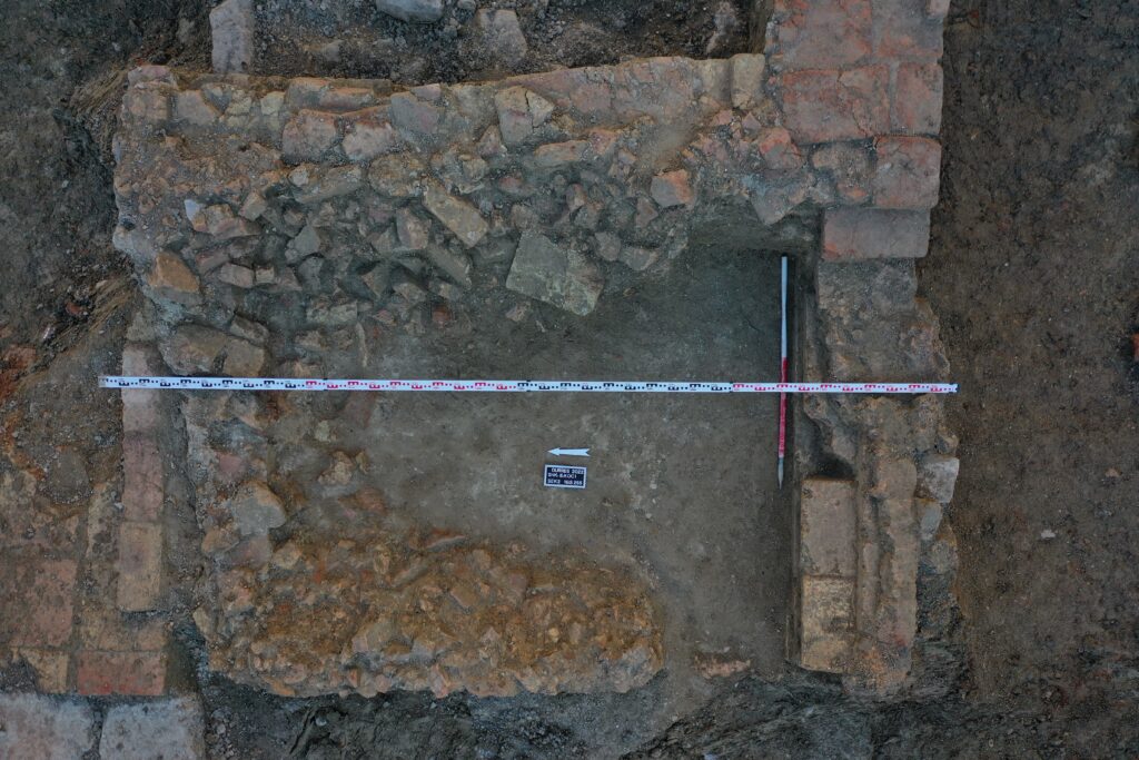
The investigated area is dominated by archaeological remains dating to the earliest periods, (Archaic, Classical, and Hellenistic periods). They are represented by the remains of a wall, as well as stratigraphic units with a significant presence of various finds such as ceramics, bricks and rooftiles. The most representative remains seem to be those of a longitudinal wall with an East-West orientation, which is preserved at the foundation level and is interpreted to possibly be a fortification wall. This structure must have been built on the ridge of a gentle hill with an abundance of water resources, as evidenced by the presence of two wells identified at the foot of the former northern slope of the hill.
On the eastern half of the excavation evidence was found of not only a continuation of the wall documented as a construction of the Archaic Period in its initial phase, but also of later interventions of the Hellenistic period. Carefully laid out rows of brickwork were observed, part of a tower like superstructure. Indications of another possible entrance dating to the Hellenistic period, blocked by rows of bricks in a later, period were also found.
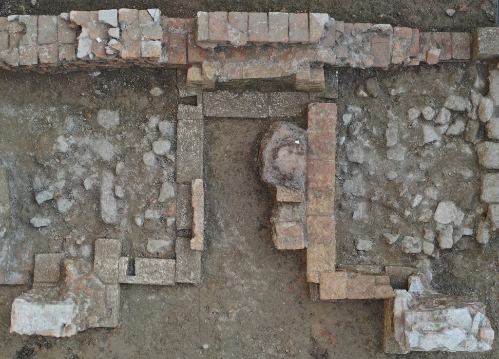
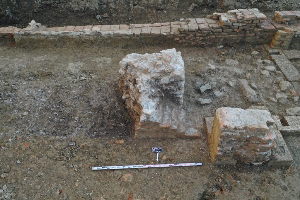
Two other structures were present, possibly two piers of a Roman era aqueduct. Their upper parts seem to have collapsed and there was a large brick collapse deposit underneath.
The fortification wall had various phases. The oldest phase, preserved at the foundation level, likely dates to the Archaic period. The wall, about 4.7m in width, is composed of two lines of rectangular blocks filled with large stones in-between. The rectangular blocks are largely made of conglomerate stone material (local to the nearby coast), along with some tufa and limestone ones. These blocks were finely worked and stacked without a binding agent. There appear to be at least four rows of blocks stacked on top of each other. The fortification wall continues beyond the excavation limit on both the eastern and western sides.
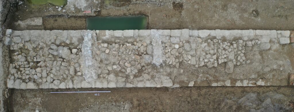
This wall appears to have been built on a gentle hill, and the eastern part of the area is significantly lower in elevation, Evidence of later phases is found in this part, possibly due to its lower elevation. What is mostly preserved is a brick construction, most of which has collapsed over the centuries, as evidenced by large deposits of collapsed bricks and tiles all around.
This wall tract may be part of the northern city wall, which separates the urban from the suburban areas, where the necropolis dating to the Archaic, Classical and Hellenistic periods is located. This idea is reinforced by a text written by Appian of Alexandria (BC II 60) when he describes Caesar's attack, aided by a local traitor. "… went (…) with a small force at night to the gates of the temple of Artemis".
This wall tract and its gates are possibly the entrances towards the temple of Artemis. The location of the votive deposits of the Artemision is about 480m from its location.
All images © Sabian Hasani, Projekti Arkaeologjik “Eftali Koçi”
 English
 Shqip